
Snow Cover Detection {Methodology Using Landsat}
NASA MODIS Land February 2004
Landsat Snow Detection Results

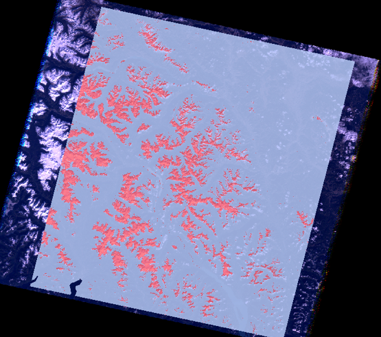
The final image here shows snow detected in pink within the study area using this Methodology. In depth visual comparison with the true color image shows that this method has very accurately determined snow cover.
A highly accurate Methodology for identifying snow cover in mountainous British Columbia terrain has been identified. To support this conclusion a comparison was done with a MODIS snow cover image of the same location and for the same cloud free day. These results show that the Landsat Methodology is a much more accurate representation of actual snow cover.
Snow cover final image and true color image for comparison.
MODIS Comparison Results
The results of comparisons for October 25, 2011 and October 6, 2010 are shown in the figures here. Light pink shows MODIS detected snow cover and red shows the Landsat Methodology detected snow cover. MODIS assigns a much larger area to snow cover than the Landsat Methodology. A visual comparison with the true color image shows that MODIS highly overestimates the actual snow cover.
|
Year |
Snow Cover Area (km2) |
% of Total Cover |
Landsat Snow Cover Area (km2) |
|
2011 |
14,154 |
51 |
4,113 |
|
2010 |
1,497 |
5 |
772 |
The implications of these results are important as the MODIS Snow Cover Data Products are widely used for climatic and hydrologic predictions. This study shows that MODIS snow cover is not very useful at the regional and local scale. The Landsat methodology developed here is much more accurate for a local scale of analysis.

October 25, 2011.
